


Attractions to Visit

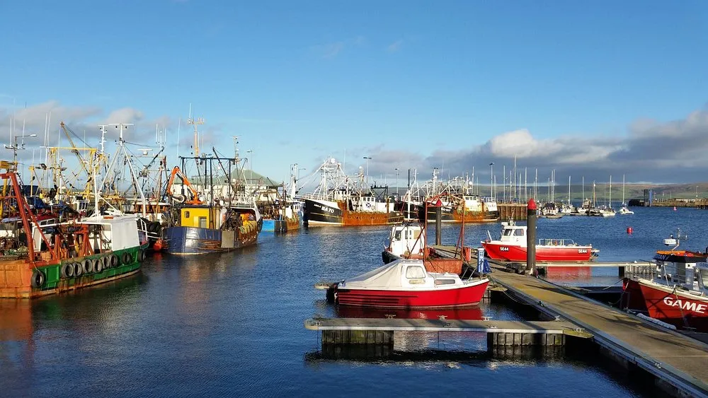
Stranraer Harbour
Rivers and Lakes, Sites and Castles
Located at the southern end of Loch Ryan, next to the town of Stranraer, Stranraer Harbour consists of a: dog-leg quay modern marina finger pontoon The finger pontoon is used by smaller fishing vessels, excursions and recreational craft. Ferry terminals are located north of the harbour and managed by a separate Statutory Harbour Authority. Stranraer Harbour is situated at a sailing cross-roads, giving access to the: Clyde Solway Isle of Man North Channel Irish Sea Boats in Stranraer Harbour Stranraer Harbour facilities Stranraer Harbour has: 69 annual berths 8 visitor berths secure pontoon mooring with CCTV monitoring water electric fuel shower and toilet The town of Stranraer has: a range of shops cafes, hotels, restaurants banks regular bus and rail links a golf course a leisure centre – Ryan Centre Harbour documents Our harbour documents section has: a berths and moorings application form our harbours directory harbour fees and charges harbour electricity supply charges
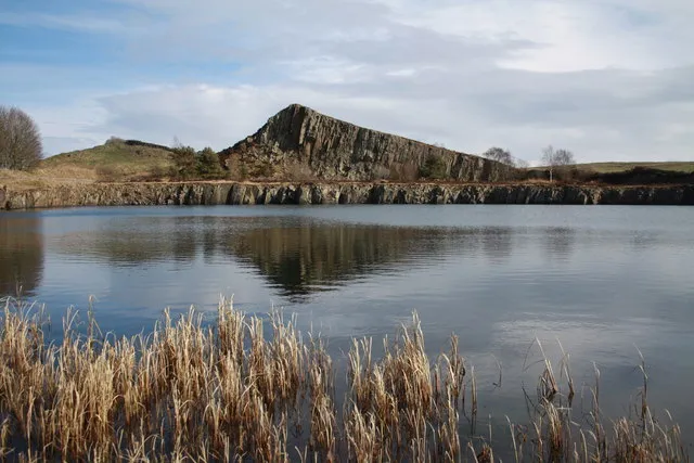
Kielder Castle and Village
Sites and Castles
A visit to Kielder Castle visitor centre will uncover many surprises. Get lost in the Minotaur Maze, discover the fascinating night sky or walk along the unique Lakeside Way, a 26 mile multi-use path around the lake which can be accessed from Kielder Castle. Take a stroll along the former track of the Border Counties Railway line to the Kielder Viaduct and absorb the staggering views of the forest and reservoir from the top. The country’s best-preserved ‘skew-arch’ bridge soars above the point where the North Tyne flows into the Bakethin Reservoir, and you can walk beneath the soaring arches once you’ve enjoyed the view from the top. Even if fishing doesn’t hook you, the nearby Kielder Salmon Centre makes for a fascinating visit. Home to the largest conservation hatchery in England and Wales, up to 900,000 salmon are bred here each year. You’ll discover the amazing life cycle of salmon and see the fresh-water pearl mussels living in their artificial stream.

Kielder Observatory
Nature and Wildlife, Galleries and Museums
Nestled in the Kielder Water and Forest Park in Northumberland, Kielder Observatory is a spectacular experience for all the family. At nearly 580 square miles, our dark sky zone, known at Northumberland and Kielder Water & Forest International Dark Sky Park, is the second largest area of protected night sky in Europe. Here the stargazing can be breath-taking: the ‘Kielder moment’ is very special, the moment that visitors look up at the glittering skies and realise that they’re completely connected to this vast cosmos, yet utterly unique within it. Like the deck of a ship sailing above the landscape, the Observatory provides astronomers with a permanent facility in the heart of Northumberland. It is part of the art and architecture programme that has turned Kielder Water and Forest Park into an open-air gallery over the last 10 years. The observatory hosts events to suit everyone: there are family events to entertain young explorers; relaxed events for people with different abilities; introductory events; legends behind the constellations events; and events focusing on phenomena such as the aurora, our moon, dark matter, and exoplanets.
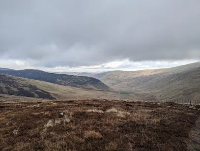
River Tweed
Rivers and Lakes
The River Tweed is a majestic waterway that has been an integral part of Scotland's history and culture for centuries. It flows through the beautiful Scottish Borders region, stretching for over 97 miles from its source in the Southern Uplands near Moffat, to its mouth at Berwick-upon-Tweed where it finally meets the North Sea. As one of the world's most iconic rivers, it has played a vital role in shaping Scotland's past and present. It was once a major trading route in medieval times, with ships carrying goods and people up and down the river. Its strategic location also made it a site of numerous battles during times of war between England and Scotland.
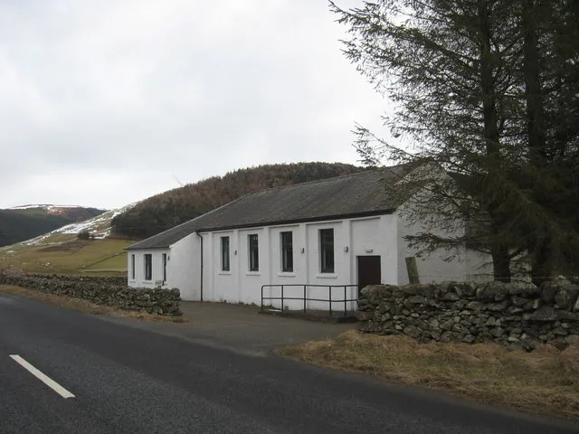
Crook Inn
Culture and Heritages, Sites and Castles
The Crook Inn has been at the heart of Tweedsmuir for more than 400 years. In 1604 it was one of three inns licensed under new laws introduced in Scotland by King James I/VI, to ’restrain the inordinate Haunting and Tippling of Inns, Alehouses, and other Victualling Houses’. It continued to offer hospitality to visitors and the community alike until its closure in 2006. In 1688 the local Minister was ousted by his congregation, who preferred the Covenanters. He took the key to the Kirk, so services were held in The Crook until the Kirk could be reopened. The next minister was ordained at the inn
Tweedsmuir Village Hall
Sites and Castles
Tweedsmuir (Scottish Gaelic: Sliabh Thuaidh) is a village and civil parish in Tweeddale, the Scottish Borders Council district, southeastern Scotland. Geography The village is set in a valley, with the rolling hills and burns on both sides, covering some fifty square miles. It incorporates settlements at Hearthstane, Cockiland, Menzion, and Oliver. Tweedsmuir was in the historic county of Peeblesshire. It is situated 8 miles (13 km) from the source of the River Tweed. History James Hogg recorded that in 1620 a severe storm remembered as 'the thirteen drifty days' caused such severe sheep losses that a glen in Tweedsmuir owned by Sir James Montgomery was converted to a common grazing and remained as such for almost a century. Landmarks and features Oliver Castle was one of the local strongholds, and later country estates, of the Clan Tweedie family. The Parish Church of Tweedsmuir was built with Scottish red sandstone in 1874 on site of earlier 1643 structure. It is a Category B listed building. There are notable Tweedie gravestones in the parish churchyard. The Crook Inn is in the village, on the A701. It is one of many claimants to be the oldest inn in Scotland. It is where Robert Burns wrote "Willie Wastle's Wife". The 22 MW Glenkerie wind farm of Infinis is located five kilometres (three miles) northwest of the village. Talla Reservoir The Talla Reservoir is nearby. In 1894 the Edinburgh and District Water Trustees decided to build Talla as the new source of water for Edinburgh. The surface and the gradient of the main road were unsuitable for carting the quantities of material that would be needed for the new reservoir, so the Talla Railway was built from Broughton to Talla. While work on the railway and the reservoir was in progress, a large number of workmen lived in Tweedsmuir, dramatically increasing the population. The valve-closing ceremony was held at Talla on 20 May 1905, and on 28 September, when the reservoir was about two-fifths full, there was an inaugural ceremony. The large company was brought from Edinburgh in two special trains, which were hauled for the last stage of the journey, from Broughton Station, by small service engines on the Talla railway.
Windermere Ferry
Rivers and Lakes, Nature and Wildlife
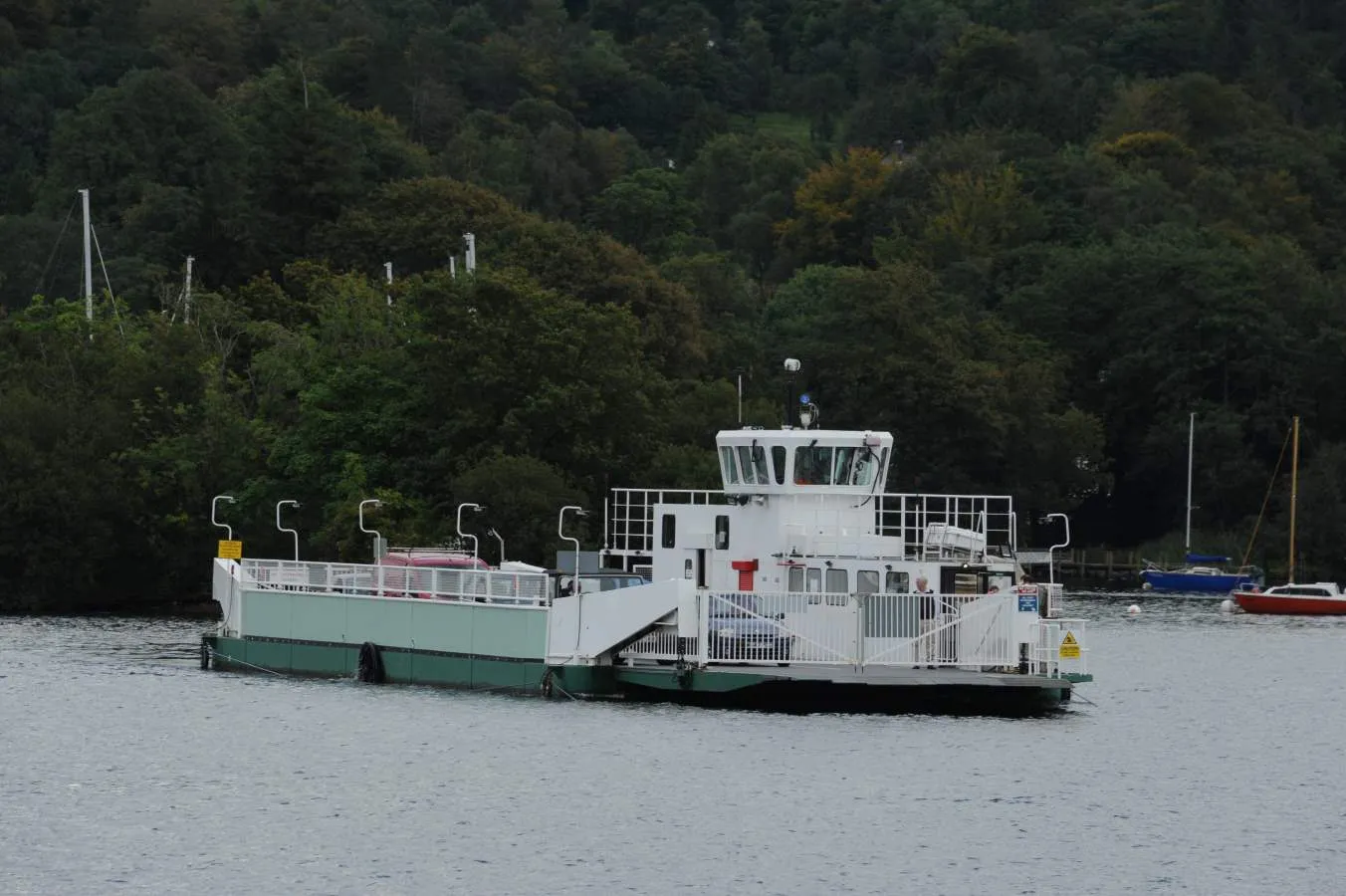
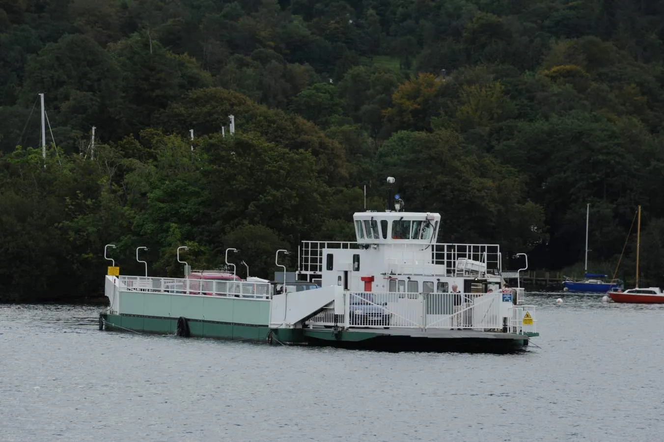
The Windermere Ferry is a vehicular cable ferry which crosses Windermere, the largest lake in England and located within English county of Cumbria.[1] The ferry route forms part of the B5285 road and crosses the lake at about its midpoint, from Ferry Nab in Bowness-on-Windermere to Ferry House at Far Sawrey, a distance of some 490 metres (540 yd). The ferry is owned and operated by Westmorland and Furness Council. The ferry operates all year, with services every 20 minutes from early morning to mid-evening. Each crossing can carry up to 18 cars and over 100 passengers and takes less than 10 minutes. A toll is charged. If the ferry is not operating, the alternative is a road journey of approximately 15 miles (24 km) around either the head or foot of the lake. The historic county boundary between Lancashire and Westmorland runs down the western shore of the lake and also along about three miles (5 km) of the southern section of the eastern shore. Anyone crossing the lake from east to west on the Windermere Ferry thus travels from the historic county of Westmorland to that of Lancashire.
Glenluce Abbey
Culture and Heritages, Sites and Castles
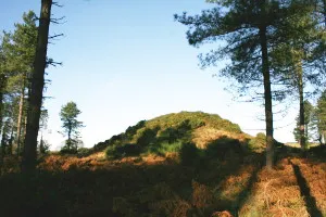
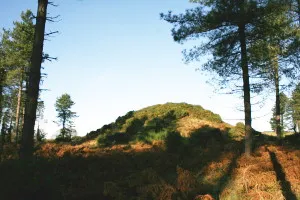
Dunragit's name means 'fort of Rheged' (Rheged was a kingdom covering parts of Northern England and South West Scotland) and the fort allegedly looks over Piltanton Burn. Dunragit's history is a long one and we have evidence of human habitation here dating back to the Stone Age. Relatively recent excavations found 3 huge concentric timber (as opposed to stone) circles with the largest being six times bigger than Stone Henge (yes, THE Stone Henge). The circular structure is thought to date from 2500 BC and can be found between Dunragit village and Droughduil Mote, though it is hard to see anything at all. Droughduil mote itself had some excavation work taken out on it and was found to date from a similar period as the timber circles - perhaps a viewpoint to look down on ceremonies taking place in the circles? Later in the villages history, Romans built their road through and it is thought there may be a Roman cemetery here. In the 18th century Dunragit's core was Dunragit House and the main employer was the now abandoned creamery.
Dunskey Gardens
Culture and Heritages
Amidst 2000 acres of spectacular Scottish countryside sits Dunskey Estate. A sprawling sanctuary, home to an Edwardian castle, luxurious lodges and panoramic views of the land and sea, it’s the perfect environment for both large group getaways and small intimate gatherings. Our team works only with trusted partners to transform the estate into your dream destination. Whether you’re looking to reconnect in nature with coworkers, loved ones, or even yourself, we’ll take care of all planning and coordination that goes along with your stay.
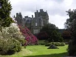
Castle Kennedy Gardens
Culture and Heritages, Sites and Castles, Galleries and Museums
The gardens surround the ruined castle of Castle Kennedy and Lochinch Castle (the current home of the Stair family). Huge rhododendrons dominate the garden as well as exotic palm trees. There are two lochs within the grounds which provide a home for geese, swans and ducks.
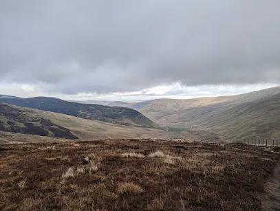
Broad Law
Rivers and Lakes, Architecture and Art, Nature and Wildlife
Broad Law is the highest hill in the Scottish Borders at 840m. Its gently mossy slopes are topped with the highest air traffic beacon in the UK. There are a few route options to access the summit of Broad Law. This is an out and back route starting just off of the A701 at Hearthstanes where the distinctive steel bridge spans the River Tweed. An alternative circular route could be taken which finishes at the Megget Stone on the Talla/Cappercleugh road. This description is only for the out and back route. Start/Parking There is parking in a layby just off the A701 next to the bridge. Please park considerately. There is also parking at the Crook Inn which involves walking along the A701 carriageway. All usual care and consideration should be taken when walking on public highways. The route is predominantly on gravel forestry roads and enables access for vehicles and personnel who need to maintain and service the radio beacon. Please be aware that there may be vehicles on this route at any time. This walk is approximately 7 miles/11km, taking 4 to 5 hours depending on fitness of the party and weather conditions. It is very pleasant walk in good weather, but the summit can resemble an Arctic landscape in winter conditions. Please dress appropriately and ensure you have the necessary equipment and skills to have a safe trip on the hills. Take the tarmac single-track road across the bridge and continue through the farmyard at Hearthstanes. The route takes a dog-leg (left and then right) as the track starts to rise gently, passing sheepfolds before picking up the track beyond the farmyard. Gates should be left as found. This is a working farm so please ensure dogs are always kept on leads Continue heading east along the main track which then heads south east as it runs parallel with Hearthstanes Burn. Stay on the main track as it emerges from forestry into more open hillside. Again, continue on this track as it rises more steeply up the slopes of Broad Law. As you approach the summit the gradient eases and the distinctive shape of the radio beacon will be visible. This can be a very handy reference point in poor visibility. Almost due south of the beacon sits the summit cairn. If you go past the beacon heading south east, you will find a stob and wire fence which could be used as a handrail and followed in a south westerly direction to reach the cairn. With good visibility, the panoramic views on offer are unsurpassed in the area. The route homewards is a reverse of your outward route.
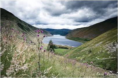
Carlowse Bridge
Rivers and Lakes, Nature and Wildlife, Walks and Activities
Carlowse Bridge Carlowse Bridge was built in 1783, replacing an earlier brig erected sometime between 1694 and 1741. The bridge was a Category C listed structure until the renovation work that Scottish Borders Council carried out in 2012. The bridge became an important crossing point of the Tweed. Before it was built, the only access to the Kirk had been via a ford and stepping stones near the current Kirk site. The small waterfall above the Bridge is named Carlow’s Linn, and the current bridge name has evolved from the original Carlow’s Brig. It is possible that the word ‘carlow’ comes from the old Scots word ‘carlin’, which is a disparaging term for an old woman: a witch. The falls may originally have been named Witches Linn, and the bridge, Witches Brig. The River Tweed rises at Tweed Wells, in the Lowther Hills in Tweedsmuir just before the boundary to Dumfries and Galloway. Both the River Annan and the Clyde rise near to Tweed Wells, heading in opposite directions. The Tweed is 97 miles/156km long, and flows east across the Scottish Borders before it meets the sea at Berwick-upon-Tweed, just across the border with England. The Tweed drops 1550 ft/472m from source to sea, and a half of this drop occurs in its first 20 miles.
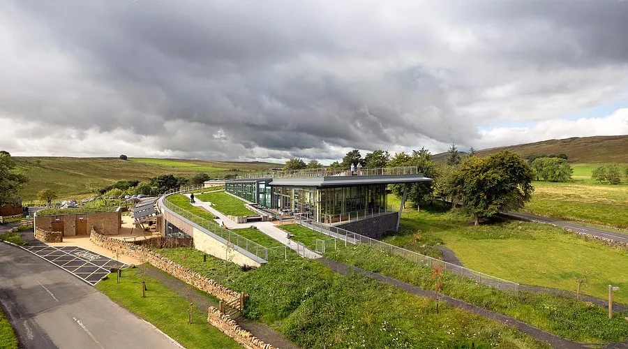
Logan Iron Age Fort
Culture and Heritages, Sites and Castles, Walks and Activities
A walk back in time, describing the lives of the people who have lived in the Logan Valley for centuries. The Iron Age Fort, later dwellings and other archaeological features of interest are explained as you walk through the hills. It is fascinating to stand where Tweedsmuir residents lived centuries ago, and see the mark they made on the landscape. This walk takes you across rough grassland, open heather hills and includes several steep climbs and descents. There are no clearly defined paths, as the walk takes you along sheep tracks, old drove roads and rough terrain at the furthest end of the walk. Some parts are boggy, and you will walk though areas of heather. The walk up Worm Hill is steep and challenging. There are 4 pedestrian gates on the route. You can choose to split the walk at the bridge over the Logan Burn, making a much easier route.
Patervan Path
Culture and Heritages, Galleries and Museums
This is a beautiful walk within sight of the River Tweed, and then along one its tributaries, Polmood Burn. You should be able to glimpse plenty of wildlife, including red squirrels, buzzards, hares and maybe even a golden eagle. At the end of the walk the landscape opens up to give spectacular views of some of the highest hills in the Borders, including Broad Law. This walk takes you along well-maintained, coarse gravel farm tracks. The route is way marked by yellow arrows on small green circular signs. You follow a well-made track up the valley and then through the grassland in Polmood Valley. There are options to extend this walk, and you should consult an OS map to plan your walk if you wish. There is a cattle grid with a pedestrian gate, and several gates to go through, which should all be left as you find them.
Top of Talla Linns
Culture and Heritages, Rivers and Lakes, Walks and Activities
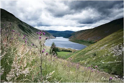
Start/Parking Parking: There is a car parking area near the start of this walk just after you cross the small bridge (if coming from Tweedsmuir), round the corner on the left-hand side of the road. The first part of the walk is on a reasonable track, although some areas are muddy and there are loose stones along the way. After the green shed, the path becomes a bit less defined and boggy. Towards the end of the track you will have to cross a burn, and there is no bridge, and avoid the wetter areas of the path. This final section requires stout footwear and a good level of fitness. Talla Linns is the name of the waterfall that cascades impressively down the hillside. The road here is also known as ‘The Linns’ locally, and is a steep single-track section that often takes visitors to the area unawares. It is untreated through the winter months, making access impossible during the snowy and frosty periods. A very impressive Victorian drainage gully runs down the side of the road. This was cleared and restored by a local volunteer in 2010, and has resulted in much safer driving conditions.
Fruid Reservoir
Culture and Heritages, Rivers and Lakes, Walks and Activities
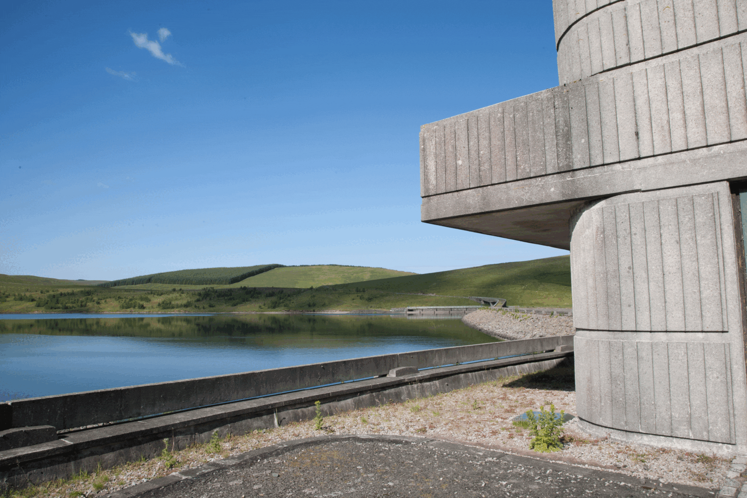
This is a beautiful walk along the banks of Fruid reservoir that will provide some amazing views at any time of the year. The high hills often are reflected beautifully in the reservoir creating some great photo opportunities. This is a gentle walk along the private road that runs along the length of Fruid reservoir to the farms at the top of the Valley. You could then choose to extend your walk by continuing along the other side of the dam, back to the start. The path on this section is not so well defined. You will have to cross cattle grids. Start/Parking Parking: There is car parking at the reservoir at the start of the walk. After parking your car, take the narrow, tarmacked road that runs to the left of the reservoir and follow this road as it winds along the length of the loch. You will pass the unusual concrete building which is the ‘retro’ control house. Fruid Reservoir was formed in the 1960s by damming the Fruid Water. The water from Fruid supplements the contents of nearby Talla Reservoir, and travels through the hillside in a tunnel. This water eventually supplies drinking water to Edinburgh. Fruid Reservoir is quite small, measuring 140 hectares. It is managed by Scottish Water. Construction on the site was completed in 1968. Farmland buildings were sacrificed to build the reservoir (including Fruid, Carterhope and Hawkshaw), and are now underneath the water. New cottages were built as replacements at the end of the reservoir. Carterhope Farm was run by the monks of Melrose Abbey in the 13th-15th Centuries, when Fruid Castle was occupied by the Frasers. The monks were faming cattle and sheep, selling fleeces and hides as well as butter and cheese (from both cow and sheep milk). The goods would have been transported by horse and cart, and local farm names reflect this: Carterhope and Hopecarton both mean ‘valley of the carts’. The monks also had a chapel and a graveyard, now lost under the water, and the baptismal font from this chapel now forms part of the signpost directing travellers at the crossroads in Tweedsmuir Village. The Chapel was located on the banks of Chapel Burn, a tributary of Fruid Water. The playwright Peter Moffat had ancestors who lived in the area that is now under the reservoir. He has cited this location as the inspiration for his 1993 TV series The Village. The series tells the story of life in a Derbyshire village in the early 20th Century.